HISTORICAL SOCIETY
Expore Historic Wilson

There is so much to see and do in both the town and village of Wilson. The Historical Society has created a map featuring historical markers, maritime trail signs, cobblestone houses, parks, pools and sculptures from the Schooling Fish public art installation.
Download your sightseeing map here.
Schooling Fish Public Art Installation
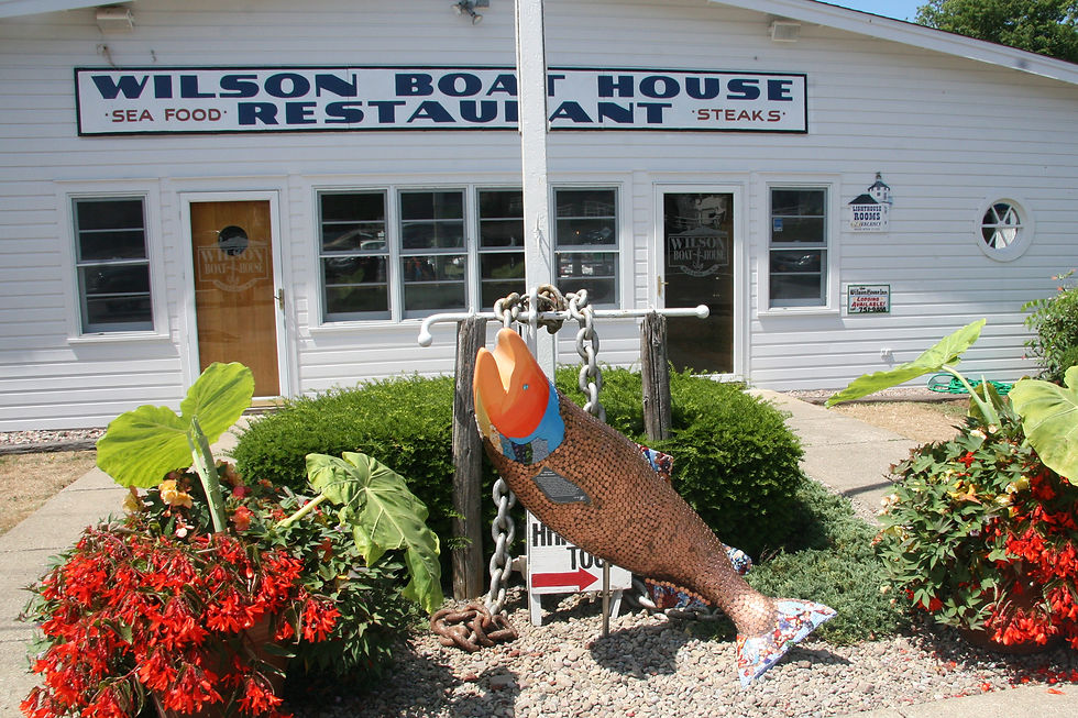
Art students from the Wilson Central School District teamed up with local businesses and community organizations to create the Schooling Fish Public Art Installment in July 2011. Seven fish sculptures are located throughout our beautiful hamlet, and each one includes a tidbit of local history. For more information, please visit the Schooling Fish website here.


Historical Markers
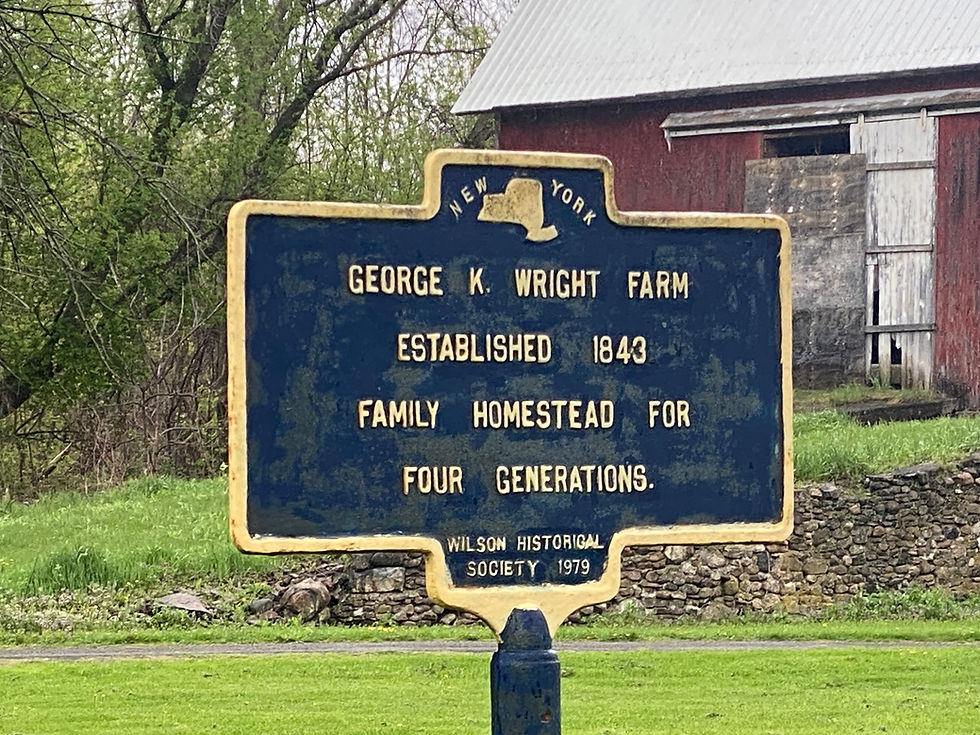
Throughout history, the Niagara Region has been a strategic consideration because of its location (near the point where the Niagara River meets Lake Ontario) and its shared border with Canada. There are several historical markers located around Wilson, marking the location of notable buildings, places and events. For more information about markers in Wilson, please visit the Historical Markers Database. Locations for markers are included in the Sightseeing Map above.

Marker is located near 4455 Lake Road (Rte. 18), east of Maple Road.

Marker is on the grounds of Calvin Krueger Park, located at 350 Ontario Street (Route 18).
Maritime Trail of History
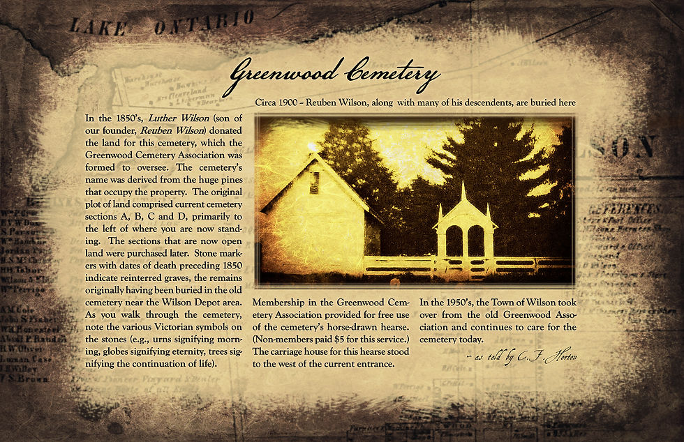
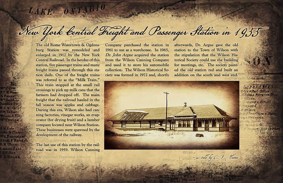
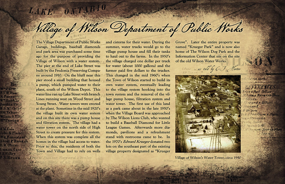
A series of 12 stanchions located throughout the Village of Wilson offer descriptions of historically significant buildings and places. Originally installed in 2015, the stanchions showcase the area's rich history, including its connection to Lake Ontario, fishing, and boating. All descriptions were written by former town historian, Charles F. Horton. Locations for stanchions are included in the Sightseeing Map above.


Cobblestone Houses Tour
The Lake Ontario plain has the unique distinction of being known as the 'land of cobblestone houses'. This plain once formed the bed of old Lake Iroquois, whose southern shore extended to the ridge that Route 104 now follows. For thousands of years as the water receded to the present shoreline, the waves produced great quantities of smooth, rounded cobblestones in the areas where early settlers would later build their homes.The cobblestones were a nuisance to farmers who cleared them from their fields, but it was the Masons who had lost their jobs when the Erie Canal was finished 1825, that saw the possibilities of the cobbles and prepared to build permanent homes for the settlers.The typical cobblestone wall was usually at least18 inches thick. It was made of large stones in a variety of sizes. Generally, only the outer facing or front wall was constructed from smaller stones of uniform size. These were obtained by carefully grading the cobbles to the size wanted by passing them through iron rings or holes cut in the boards. The corners of a building were formed by using large, smooth, square-cornered stones called quoins with the thickness of the cobblestone spacing determined by the thickness of the quoin. Lentils were the horizontal cross pieces over the doors and windows that carried the weight of the structure above them. Download the Cobblestone Homes Tour Guide here.


